|

|
Research project reports
| Giotis Α., Veis G., Psarianos
V., Nakos Β., 1992, “A GIS application representing the road network of
municipality of Athens”. Reseach Report. National Technical University
of Athens, Athens. (In Greek) |
| Vosikis V., Georgopoulos A.,
Nakos B., 1992, “Integrated System for Administration and Control. A
feasibility study”. Technical Report, Directorate-General for
Agriculture, EAGGF VI G4, GEOMET Ltd. |
| Kontaratos Μ., Maraggou Μ.,
Nakos Β., 1993, “A study on the digitization of the photogrammetric survey of
municipality of Tavros at scale 1:1,000”. Technical Report, PMS Ltd.,
Athens. (In Greek) |
| Maroukis J., Nakos Β., 1993, “The
design and development of the GIS of the city of Ioannina”. Technical
Report, ΑΜΑ Ltd., Athens. (In Greek) |
| Athanassoulis G. A.,
Skarsoulis E. K., Stefanakos Ch. N., Nakos B., Tsoulos L., Skopeliti
A., 1995, “ATLAS OF WAVE ENERGY RESOURCE IN EUROPE. Structure and
Implementation of WERATLAS Software”. Interim Report of WERATLAS
project (JOU2-CT93-0390). |
| Veis G., Vardis Ch., Giotis
Α., Zacharis Ε., Korakitis R., Liapakis Ch., Balis V., Billiris Ch.,
Nakos Β., Paradisis D., Psarianos V., 1998, "Digital representation of the
national road network". Research Report. National Technical University
of Athens. (In Greek) |
| Veis G., Vardis Ch., Giotis
Α., Zacharis Ε., Korakitis R., Liapakis Ch., Balis V., Billiris Ch.,
Nakos Β., Paradisis D., Psarianos V., 1998, "Digital representation of the
national road network". Manual of data management. National Technical
University of Athens. (In Greek) |
| Veis G., Vardis Ch., Giotis
Α., Zacharis Ε., Korakitis R., Liapakis Ch., Balis V., Billiris Ch.,
Nakos Β., Paradisis D., Psarianos V., 1998, "Digital representation of the
national road network". Manual of specifications. National Technical
University of Athens. (In Greek) |
| Papajiannakos Ν., Karras G.,
Nakos Β., Herie Ε., Mariolopoulos D., Tsatsaris A., Petsa E., 1998, "A study
for the restoration of the ancient theater of Thassos island".
Technical Report. (In Greek) |
| National Statistical Service
of Greece, 1998, "Technical specifications for the creation of a new digital
base map". Research Report, Athens. (In Greek) |
| Tsoulos L., Filippakopoulou
V., Nakos B., Skopeliti A. Stefanakis, C., Stamou L., Michaelidou E.,
1999, EuroSTAT – GISCO – LOT5 Cartography. Social and Regional Statistics.
Ref: 87280003. Technical Summary. Cartography Laboratory, N.T.U.A. |
| Tsoulos L., Filippakopoulou
V., Nakos B., Skopeliti A. Stefanakis, C., Stamou L., Michaelidou E.,
1999, EuroSTAT – GISCO – LOT5 Cartography. Social and Regional Statistics.
Ref: SOEC 9728001. Interim Report. Cartography Laboratory, N.T.U.A. |
| Psarianos V., Kontaratos Μ.,
Nakos Β., 1999, "Evaluation of the north road network of the island of
Crete from Kasteli to Setea". Research Report. National Technical
University of Athens. (In Greek) |
| Filippakopoulou V., Kontoes
Ch., Michaelidou Ε., Nakos Β.,Tzelepis Ν.,1999, "Design and production of
series of basic topographic maps at scale of 1:25,000". Technical
Report (Part Α). (In Greek) |
| Filippakopoulou V., Kontoes
Ch., Michaelidou Ε., Nakos Β.,Tzelepis Ν., 1999, "Design and production of
series of basic topographic maps at scale of 1:25,000". Technical
specifications (Part Β). (In Greek) |
| Filippakopoulou V.,
Michaelidou Ε., Nakos Β., Stamou L., 2004, "An evaluation on the selectivity
of visual variables", Research Report, National Technical University of
Athens. (In Greek) |
| Nakos Β., Vougioukas Ε.,
Zannou D., 2005, "An assessment of the built environment of Greece". Research
Report, Technical Chamber of Greece. (In Greek) |
| Nakos Β., Mitropoulos V.,
2006, "The develpoment of methods for detecting critical points on
cartographic lines". Research Report, National Technical University of
Athens. (In Greek) |
| Nakos Β., Vougioukas Μ.,
Tzelepis Ν., Zannou D., Zacharis Ε., 2009, "The development of a GIS software
for the representation of built environment and its seismic
vulnerability". Research Report, National Technical University of
Athens. (In Greek) |
| Nakos Β., Mitropoulos V.,
2011, "Cartographic generalisation of natural occuring lines based on visual
perception principles". Research Report, National Technical University
of Athens. (In Greek) |
Books and lecture notes of courses
| Mitsakaki Ch., Nakos Β.,
Tsoulos L., Filippakopoulou V., 1988, Lecture Notes of General Cartography.
School of Rural & Surveying Engineering, Athens: National Technical
University of Athens. (In Greek) |
| Nakos Β., Tsoulos L.,
Filippakopoulou V., 1988, Lecture Notes of Thematic Cartography. School of
Rural & Surveying Engineering, Athens: National Technical University of
Athens. (In Greek) |
| Nakos Β., 1990, Thematic Cartography
- Supplementary Lecture Notes. School of Rural & Surveying
Engineering, Athens: National Technical University of Athens. (In
Greek) |
| Nakos Β., Filippakopoulou V., 1991,
Lecture Notes of General Cartography. School of Rural & Surveying
Engineering, Athens: National Technical University of Athens. (In
Greek) |
| Nakos Β., Filippakopoulou V.,
1992, Lecture Notes of Thematic Cartography. School of Rural & Surveying
Engineering, Athens: National Technical University of Athens. (In
Greek) |
| Maroukis J., Nakos Β., 1993, GIS
technology and local authorities. Ioannina: Municipality of Ioannina. (In
Greek) |
| Department of Transportation,
1998, Wayfarers at the center of
the city of Athens. Athens: National Technical University of Athens. (In Greek) |
| Kavouras Μ., Nakos Β., Tsoulos
L., Filippakopoulou V., Tomai E. (Εds.), 2002, Elements of
Cartography (Stoixeia Xartografias).
Athens: National Technical University of Athens, (Robinson
A.H., Morrison J.L., Muehrcke Ph.C., Kimerling A.J., Guptill S.C.,
1995, Elements of Cartography, New York: John Willey & Sons Inc.)
(Greek translation) |
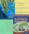
| Nakos Β., Filippakopoulou V., 2006,
My first school atlas (O protos mou scholikos atlantas), Athens: Patakis
Pub. (In Greek) |
| Nakos Β., 2009, Lecture Notes of
Mathematical Cartography. School of Rural & Surveying Engineering,
Athens: National Technical University of Athens. (In Greek) |
| Nakos Β., 2009, Lecture Notes of
principles of visualization. School of Rural & Surveying
Engineering, Athens: National Technical University of Athens. (In
Greek) |
| Nakos Β., 2011, Analytical
Cartography. School of Rural & Surveying Engineering, Athens: National
Technical University of Athens. (In Greek) |
| Νakos Β., 2015, Αnalytical Cartography. Athens: Hellenic Academic Libraries Link. (Available in: http://hdl.handle.net/ 11419/2233) |
Dissertations
Publications in informative journals
| Psarianos V., Nakos Β., 1992, “A GIS
application for the city of Athens”. Pyrforos, 2-3: 54-7. (In Greek) |
| Tzelepis Ν., Nakos Β.,
1994, “Hillshading and maps”, Pyrforos. 16: 44-8. (In
Greek) |
| Georgopoulos Α., Mavromati D.,
Nakos Β., 1995, “The map of Zographos campus using digital photogrammetric
techniques and CAD technology”. Pyrforos, 18: 32-8. (In Greek) |
Papers presented at conferences and technical
meetings
| Nakos Β., Filippakopoulou V.,
1982, “Thematic mapping of the topologically transformed road network with
computer aided techniques”. Paper presented at the Technical Meeting:
Thematic Maps for Urban Development. Photogrammetric Association of
Greece, Athens. (In Greek) |
| Doganis Th., Kostakis D.,
Nakos Β., 1985, “Information theory and the Rural and Surveying Engineer”.
Paper presented at the Seminar: Trends and Progress on the Science of
Rural and Surveying Engineer, Athens. (In Greek) |
| Sakellariou Μ., Mitsakaki Ch.,
Nakos Β., 1989, “The fractal dimension of rock discontinuities. Application
on geophysics”. Paper presented at the 1st Scientific Conference of
Geophysics, Athens. (In Greek) |
| Nakos Β., 1990, “GIS a
technology for spatial analysis”. Paper presented at the Tecnhical
Meeting: The engineers and Information Theory Applications, Technical
Chamber of Greece, Athens. (In Greek) |
| Nakos Β., Psarianos V., 1991, “A GIS
application of land uses associated to the road network of urban
regions”. Paper presented at the 1st Arc/Info Users Meeting, Athens. (In Greek) |
| Nakos Β., Maraggou Μ., 1992, “The
use of GIS technology for creating thematic maps”. Paper presented at
the 2nd Arc/Info Users Meeting, Athens. (In Greek) |
| Filippakopoulou V., Nakos B.,
Alexopoulou V., Skenteris K., 1993, “The Creation of a National Atlas of
Greece Using GIS Technology”. Paper presented at the 8th European
Arc/Info User Conference, 11-13 Oct., Athens. |
| Nakos Β., Papadopoulou Th.,
Filippakopoulou V., 1993, “A digital tourist map of Skopelos”. Paper
presented at the Technical Meeting: Local Othorities and GIS
Technology, Kos (Greece). (In Greek) |
| Skopeliti Α., Nakos Β.,
Tsoulos L., 1994, “The development of the Wave Energy Atlas using pc Arc/Info
software”. Paper presented at the 4th Arc/Info Users Meeting, Athens. (In Greek) |
| Argyraki S., Nakos Β.,
Filippakopoulou V., 1994, “A user interface software for the management of
digital maps”. Paper presented at the 4th Arc/Info Users Meeting,
Athens. (In Greek) |
| Veis G., Vardis Ch., Giotis
Α., Zacharis Ε., Korakitis R., Liapakis Ch., Balis V., Billiris Ch.,
Nakos Β., Paradisis D., Psarianos V., 1995, “The development of an integrated
system monitoring the road network”. Paper presented athe 1st Hellenic
Conference of Road Construction, Tecnical Chamber of Greece, Larissa
(Greece). (In Greek) |
| Papajiannakos Ν., Karras G.,
Herie Ε., Nakos Β., Mariolopoulos D., Petsa E., Tsatsaris A., 1995, “The
documantation of the morphologic and constructive status of the idols
of the ancient theater of Thassos in view of their restoration using
the Arc/Info software”. Paper presented at the 5th Arc/Info Users
Meeting, Athens. (In Greek) |
| Nakos Β., 1997, “HellasRoads – A
digital system for monitoring the national road network”. Paper
presented at the Technical Meeting: From Surveying to Geoinformation,
Technological Educational Institute of Athens, Athens. (In Greek) |
| Veis G., Filippakopoulou V.
Kavouras M., Νakos Β., Τsoulos L., 1997, “Cartography in the Faculty of Rural
and Surveying Engineering of National Technical University of Athens”.
Workshop on Cartographic Curricula & Research in Tertiary Education
in the Balkans, Thessaloniki (Greece). |
| Filippakopoulou V. Kavouras
M., Νakos Β., Τsoulos L., 1998, “Teaching and research activities in
cartography under Faculty of Rural and Surveying Engineering of the
National Technical University of Athens”. International Cartographic
Workshop: Cartography in South-East Europe, Thessaloniki (Greece). |
| Karras G., Nakos Β.,
Tsiliggiris E., 2000, “A photogrammetric survey of dorsal surfaces of
pregnant women”. Paper presented at the 26th Symposium on Spinal
Disorders, Delphoi (Greece). (In Greek) |
| Nakos Β., 2006, "The information
society and geoinformation". GIS Users Conference, CYTA, Lefkosia (Cyprus). (In Greek) |
Publications in conferences proceedings
| Doufexopoulou M., Nakos B.,
1989, “DEM Derived from Existing Maps for Use in Geosciences”. Proceedings of
the International Symposium on Modern Geodetic Measurements and Digital
Techniques, Budapest (Hungary), 256-71. |
| Nakos Β., Filippakopoulou V.,
Papadopoulou D., Doumplidis P., Papadopoulou Th., 1994, “The development of a
tourist information system in the frame of GIS technology as an
evolution of the analogue tourist map”. Proceedings of the 1st National
Cartographic Conference, Hellenic Cartographic Society, Thessaloniki
(Greece), 201-14. (In Greek) |
| Nakos B., Balis V., Liapakis
Ch., 1995, “GPS and GIS Integration in Cable Laying Applications”.
Proceedings of the Fifth International Offshore and Polar Engineering
Conference, The Hague (The Netherlands), 120-5. |
| Filippakopoulou V., Kavouras
M., Nakos B., Tsoulos L., 1995, “Design and Implementation of Special-Purpose
Electronic Atlases”. Proceedings of the 17th International Cartographic
Conference, Barcelona (Spain), 2792-7. |
| Pontes M. T., Athanassoulis G.
A., Nakos B., Tsoulos L., Stefanakos Ch. N., Skopeliti A., Frutuoso R.,
1995, “European Wave Energy Atlas: An Interactive PC-Based System”.
Proceedings of the 2nd European Wave Power Conference, Lisbon
(Portugal). |
| Tzelepis Ν., Nakos Β., 1995, “An
Assessment of hillshading methods”. Proceedings of the 2nd National
Cartographic Conference, Hellenic Cartographic Society, Volos (Greece), 275-83. (In Greek) |
| Skopeliti Α., Tsoulos L.,
Nakos Β., 1995, “The development of an electronic atlas using Visual Basic
programming language”. Proceedings of the 2nd National Cartographic
Conference, Hellenic Cartographic Society, Volos (Greece), 285-91. (In Greek) |
| Nakos Β., 1995, “The use of fractal
geometry theory in automated generalization”. Proceedings of the 2nd
National Cartographic Conference, Hellenic Cartographic Society, Volos
(Greece), 293-301. (In Greek) |
| Nakos
Β., Tsoulos L., 1995, “Cartographic databases and erros”. Proceedings
of the Technical Meeting: Digital Cartography, Photogrammetry &
Remote Sensing - Innovative Technologies, Technica Chronica, Τechnical
Chamber of Greece, Athens, 44-51. (In Greek) |
| Papadopoulou D., Nakos
Β., 1996, “The digital mapcase. A software for managing collections of
maps”. Proceedings of the 3rd National Cartographic Conference,
Hellenic Cartographic Society, Kalamata (Greece), 71-80. (In
Greek) |
| Tzelepis Ν., Skopeliti Α.,
Nakos Β., 1996, “The use of object-oriented programming in dynamic thematic
mapping of large scales”. Proceedings of the 3rd National Cartographic
Conference, Hellenic Cartographic Society, Kalamata (Greece), 161-70. (In Greek) |
| Nakos B., 1997, “Fractal geometry
theory in performing automated map generalization operations”.
Proceedings of 2nd Workshop on Progress in Automated Map
Generalization, ICA-WG of Map Generalization, Gävle (Sweden). |
| Michaelidou E., Nakos B.,
Filippakopoulou V., 1997, “A study on the ability of children in
understanding the fundamental elements of reality presented on maps”.
Proceedings of 18th International Cartographic Conference, Stockholm
(Sweden), 933-42. |
| Nakos Β., 1997, “An analysis of
maps portraying mountainous regions”. Proceedings of the 4th National
Cartographic Conference, Hellenic Cartographic Society, Kastoria
(Greece), 13-22. (In Greek) |
| Nakos Β., Filippakopoulou V.,
1998, “The cartographic component of a didactic of geography. A critical
analysis on the first grade high school textbook of geography”.
Proceedings of the 1st Hellenic Conference on the Didacic of Physical
Sciences and the Application of Innovative Technologies in Education,
Thessaloniki (Greece), 515-21. (In Greek) |
| Filippakopoulou V.,
Michaelidou E., Nakos B., 1998, “A study of children’s perception of
cartographic landform representation”. Proceedings of the Joint Seminar
on Maps for Special Users, Wroclaw (Poland), 93-104. |
| Nakos Β., Tzelepis Ν.,
1998, “Three-dimensional representation of built environment by applying
realism”. Proceedings of the 5th National Cartographic Conference,
Hellenic Cartographic Society, Thessaloniki (Greece), 273-81.
(In Greek) |
| Filippakopoulou V.,
Michaelidou E., Nakos B., 1999, “The Use of Primary Graphic Elements in Map
Design by First and Second Grade Students”. Proceedings of the
Conference: Discovering Cartographic Concepts, ICA-WG Cartography and
Children, Montreal (Canada), 58-63. |
| Nakos B., 1999, “Comparison of
manual versus digital line simplification”. Proceedings of ICA’99
Workshop: Progress and Development in Automated Map Generalization,
Ottawa (Canada). |
| Nakos B., Filippakopoulou V.,
Michaelidou E., 1999, “The Interaction of the Didactic of Cartography and
Geography”. Proceedings of 19th International Cartographic Conference,
Ottawa (Canada), 511-9. |
| Nakos B., 2000, “The Problem of
Cartographic Generalization in the Context of Fractal Geometry”.
Proceedings of 1st Interdisciplinary Symposium on NonLinear Problems,
National Technical University of Athens, Athens, 297-308. |
| Nakos B., Georgopoulos A.,
2000, “The potential of applying 3-D visualisation methods for representing
destroyed settlements”. International Archives of Photogrammetry and
Remote Sensing, Vol. XXXIII, Part B5/1, Commission V, Amsterdam, 285-90. |
| Filippakopoulou V., Nakos B.,
Michaelidou E., 2000, “Children’s Understanding of Generalisation
Transformations”. Conference on Teaching Maps for Children: Theories,
Experiences and Perspectives Beginning the 3rd Millennium.
International Cartographic Association, Budapest, 12-8. |
| Myridis Μ., Nakos Β.,
Filippakopoulou V., 2000, “Spatial analysis and visualization of the
population evolution of Kythera”. Proceedings of the 1st International
Conference on the Studies of Kythera: Kythera a Myth and Reality,
Kythera (Greece). (In Greek) |
| Nakos Β., Filippakopoulou V.,
Michaelidou Ε., 2000, “The evolution of mental maps of Greece of school
children”. Proceedings of the 2nd Hellenic Conference on the Didactic
of Physical Sciences, Lefkosia (Cyprus), 266-77. (In Greek) |
| Filippakopoulou V., Nakos Β., Stamou L, 2000, “The cartographic visualization of the evolution of several
demographic indicies”. Proceeding of the Conference on the Spatial
Dimensions of Demographic Phenomena. Department of Regional Planning,
University of Thessalia, Volos (Greece), 167-75. (In Greek) |
| Filippakopoulou V., Nakos B.,
Patalas Ch., Yaksoglou I., 2000, “Design and Development of A Large Scale
Archaeological Information System. A Pilot Study for the City of
Sparti”. International Symposium on Application of Geodetic and
Information Technologies in the Physical Planning of Territories, Sofia
(Boulgaria), 203-10. |
| Michaelidou Ε.,
Filippakopoulou V., Nakos Β., Stamatopoulos Α., 2000, “The use of visual
variables in the design of maps for children of the first, second and
third grade of elementary school”. Proceedings of the 6th National
Cartographic Conference, Hellenic Cartographic Society, Athens, 83-92. (In Greek) |
| Aga Ε., Ganiatsa Ε., Karras
G., Bitzileki Ch., Nakos Β., 2000, “Realistic visualization of 3D models
using digital images applied to large scale representations”.
Proceedings of the 6th National Cartographic Conference, Hellenic
Cartographic Society, Athens, 377-88. (In Greek) |
| Νakos
Β., Filippakopoulou V., 2001, “Cartographic Education in NTUA. Current
Status and Future Perspectives”. Proceedings of E-Mail Seminar in
Cartography. University of Architecture, Civil Engineering and Geodesy.
Sofia, 63-71. |
| Psarianos B., Paradisis D.,
Nakos B., Karras G., 2001, “A Cost-Effective Road Surveying Method for the
Assessment of Road Alignments”. Proceedings of the 4th International
Symposium Turkish-German Joint Geodetic Days, Berlin. |
| Nakos B., 2001, “On Quantitative
Shape Analysis of Sliver Polygons Created by Line Simplification”.
Proceedings of the GIS Research UK–9th Annual Conference. University of
Glamorgan (Wales), 29-31. |
| Nakos B., 2001, “On the Assessment
of Manual Line Simplification Based on Sliver Polygon Shape Analysis”.
Proceedings of ICA 2001 Workshop: Progress and Development in Automated
Map Generalization, Beijing (China). |
| Tzelepis N., Nakos B.,
2001, “Methods and techniques for the correction of natural shades on
aerial-photo or satellite maps”. Proceedings of 20th International
Cartographic Conference, Beijing (China), 672-80. |
| Filippakopoulou V.,
Michaelidou E., Nakos B., 2001, “Design and implementation of a prototype
software for introducing cartography to children”. Proceedings of 20th
International Cartographic Conference, Beijing (China), 2963-71. |
| Michaelidou Ε., Nakos Β.,
Filippakopoulou V., 2002, “Design and development of educational software
introducing cartographic concepts to high school children”. Proceeding
of the 3rd Hellenic Conference on the Didactic of Physical Sciences,
Rethimno (Greece). (In Greek) |
| Nakos Β., Filippakopoulou V.,
Stamou L., 2002, “The impact of line generalization on the length of
coastlines of Greece”. Proceedings of the 7th National Cartographic
Conference, Hellenic Cartographic Society, Mytilini (Greece), 279-90. (In Greek) |
| Vavasis G., Assimakopoulou
G., Georgopoulos G., Kontoes Ch., Nakos Β., Paggou Κ., Paradisis
D., 2002, “On the processing and visualization of SEAWifs satellite images”.
Proceedings of the 7th National Cartographic Conference, Hellenic
Cartographic Society, Mytilini (Greece), 397-405. (In Greek) |
| Filippakopoulou V., Nakos B.,
Michaelidou E., 2002, “Exploring Children’s Ability to Categorize and
Symbolize”. Proceedings of Workshop Cartografia para Escolares no
Brazil, ICA-Commission on Cartography and Children, Belo Horizonte
(Brazil), 173-8. |
| Hypsilanti Α., Nakos Β., 2003, “The
linear focal projection”. Proceeding of the 3rd Hellenic Conference on
the Geoinformation Society, Hellenic Society of GIS, Athens (Greece). (In Greek) |
| Nakos B., Mitropoulos V.,
2003, “Local length ratio as a measure of critical points detection for line
simplification” Proceedings of 5th Workshop on Progress in Automated
Map Generalization, Commission Map Generalization, International
Cartographic Association, Paris (France). |
| Michaelidou E., Nakos B.,
Filippakopoulou V., 2003, “Spatial knowledge acquisition in children of
different cultures”. Proceedings of 21th International Cartographic
Conference, Durban (South Africa). |
| Tzelepis N., Nakos B., 2003, “A
study on the lightning factors affecting relief presentation”.
Proceedings of 21th International Cartographic Conference, Durban
(South Africa). |
| Jiang B., Nakos B., 2003, “Line
Simplification Using Self-Organizing Maps”. Proceedings of ISPRS
Workshop on Spatial Analysis and Decision Making, Hong Kong. |
| Filippakopoulou V.,
Michaelidou E., Nakos B., 2004, “Application of visual variables in
portraying nominal, ordinal and numerical data by school students”.
Proceedings of International Symposium on Expanding Horizons in a
Shrinking World, IGU-Commission on Geographical Education and
ICA-Commission on Cartography and Children, Glasgow (United Kingdom), 134-13. |
| Vavasis G., Kontoes Ch.,
Nakos Β., Georgopoulos D. 2004, “An account on the physical and dynamical
characteristics of the sea surfaces in Greece using remote sensing”.
Proceedings of the 6th Hellenic Conference for the Environment on
Integrated Development & Environment, Thessaloniki (Greece).
(In Greek) |
| Papachristodoulou Α., Nakos
Β., 2004, “A method of data classification for choropleth maps using
Self-Organized Maps”. Proceedings of the 8th National Cartographic
Conference, Hellenic Cartographic Society, Thessaloniki (Greece), 369-81. (In Greek) |
| Tsaggaraki Α.,
Filippakopoulou V., Nakos Β., 2004, “A digital tourist guide of the historic
center of Athens”. Proceedings of the 8th National Cartographic
Conference, Hellenic Cartographic Society, Thessaloniki (Greece), 103-8. (In Greek) |
| Mitropoulos V., Xydia A.,
Nakos B., Vescoukis V., 2005, “The use of epsilon-convex area for attributing
bends along a cartographic line”. Proceedings of: 23rd International
Cartographic Conference, A Coruna (Spain). |
| Filippakopoulou V., Nakos Β.,
Katsinis Α., Panoutsopoulos D., Kontaratos Μ., 2005, “A study on the
orientation in the urban space of navigation systems users”.
Proceedings of the 3rd International Conference on the Research in
Transportation in Greece, Thessaloniki (Greece), 548-55. (In
Greek) |
| Michaelidou E.,
Filippakopoulou V., Nakos B., Petropoulou A., 2005, “Designing point map
symbols: The effect of preattentive attributes of shape”. Proceedings
of 23rd International Cartographic Conference, A Coruna (Spain). |
| Mitropoulos V., Nakos Β.,
2006, “The ∈-strips and the hierarchicaly structured trees applied to line
simplifiation”. Proceedings of the 9th National Cartographic
Conference, Hellenic Cartographic Society, Chania (Greece), 501-19. (In Greek) |
| Filippakopoulou V., Nakos Β.,
Kontaratos Μ., Katsinis Α., 2006, “2D and 3D representations for the
orientation in the urban space road network using navigation systems”.
Proceedings of the 9th National Cartographic Conference, Hellenic
Cartographic Society, Chania (Greece), 419-28. (In Greek) |
| Loisios D., Tzelepis N.,
Nakos B., 2007, “A methodology for creating analytical hillshading by
combining different lighting directions”. Proceedings of: 24th
International Cartographic Conference, Moscow (Russia). |
| Nakos B., Gaffuri J.,
Mustière S., 2008, “A transition from simplification to generalization of
natural occurring lines”. Proceedings of 11th ICA Workshop on Map
Generalisation and Multiple Representation, Monpellier (France). |
| Tzelepis, Ν., Loisios, D.,
Nakos Β., 2008, “A new method of analytical hillshading by using different
lighting directions”. Proceedings of the 10th National Cartographic
Conference, Hellenic Cartographic Society, Ioannina (Greece), 539-49. (In Greek) |
Nakos Β., 2010, “A review of map
projection systems applied in Greece”. Proceedings of the 11th National
Cartographic Conference, Hellenic Cartographic Society, Nafplio
(Greece), 111-26.
|
| Mitropoulos
V., Nakos B., 2011, “A methodology on natural occurring lines segmentation
and generalization”. Proceedings of 14th ICA Workshop on Map
Generalisation and Multiple Representation, Paris, France. |
| Krassanakis
V., Filippakopoulou V., Nakos B., 2011, “The influence of attributes of shape
in map reading process”. Proceedings of 25th International Cartographic
Conference, Paris, France. |
| Krassanakis V.,
Filippakopoulou V., Nakos B., 2011, “An Application of Eye Tracking
Methodology in Cartographic Research”, Proceedings of the
EyeTrackBehavior 2011 (Tobii), Frankfurt (Germany). |
| Nakos B.,
Tzelepis N., Zacharis E., 2012, “A GIS system of built environment and
seismic vulnerability of buildings. The case of the city of Kozani ”.
Proceedings of 12th National Cartographic Conference, Hellenic
Cartographic Society, Kozani (Greece), 113-27. (In Greek)
|
| Krassanakis V., Lelli A.,
Lokka I.-E., Filippakopoulou V. & Nakos B.,
2013, “Investigating dynamic variables with eye movement
analysis”. Proceedings of 26th
International Cartographic Conference, Dresden (Germany). |
| Bargiota Th., Mitropoulos V.,
Krassanakis V. & Nakos B. 2013, “Measuring locations of critical points
along cartographic lines
with eye movements”. Proceedings of 26th
International Cartographic Conference, Dresden (Germany). |
Krassanakis
V., Lelli A., Lokka I.-E., Filippakopoulou V. & Nakos B. 2013, "Searching
for salient locations in topographic maps". Proceedings of the First International Workshop on Solutions
for Automatic Gaze-Data Analysis (Pfeiffer Th. & Essig K.
eds.), Bielefeld (Germany), 41-44.
(DOI:
10.2390/biecoll-saga2013_11)
|
Krassanakis V., Mitropoulos V. & Nakos B. 2013, “A
cartographic approach of the process of map symbolization on gvSIG
software”, Proceedings of 9th
International gvSIG Conference, Valencia (Spain).
|
| Karagiorgou
S., Krassanakis V., Vescoukis V., Nakos B. 2014, “Experimenting with
polylines on the visualization of eye tracking data ftom observations
of cartographic lines”, Proceedings of 2nd International Workshop on Eye Tracking for Spatial Research, Vienna, Austria. |
Alevizakis A., Nakos B., 2014, "An interactive sound map published through the internet. The noise map of the city of Veroia". Proceedings of 13th National Cartographic Conference, Hellenic
Cartographic Society, Patras (Greece). (In Greek)
|
| Papapostolou A., Nakos B., 2014, "Interactive and dynamic web mapping using open source software. The visualization of the Asia Minor campaign". Proceedings of 13th National Cartographic Conference, Hellenic
Cartographic Society, Patras (Greece). (In Greek) |
| Tzelepis N., Krassanakis.V., Nakos B., 2014, "The use of free/open source software (FOSS) to create web maps for education". Proceedings of 13th National Cartographic Conference, Hellenic
Cartographic Society, Patras (Greece). (In Greek) |
| Misthos
L.-M., Nakos B., Mitropoulos V., Krassanakis V., Menegaki M. &
Batzakis D.-V., 2015, "The Effectiveness of Propagating Viewsheds’
Geovisualization from Topographically Prominent Viewroutes".
Proceedings of the 10th International Congress of the Hellenic Geographical Society. Thessaloniki: School of Geology, Aristotle University of Thessaloniki, 55-76. |
Publications in journals and books
| Doufexopoulou M., Milas P.,
Nakos B., Papafitsorou A., 1989, “On the relation between the gravity field
and lithospheric features in the Greek area”. Acta Geod. Geoph.
Mont. Hung. 24(3-4): 213-36. |
| Sakellariou M., Nakos B.,
Mitsakaki C., 1991, “On the fractal character of rock surfaces”. Int. J.
Rock Mech. Min. Sci. & Geomech. Abstr., 28(6): 527-33. |
Veis G., Billiris H., Nakos
B., Paradissis D., 1992, “Tectonic strain in Greece from geodetic
measurements”. Proceedings of the Academy of Athens, 67: 129-66. (In Greek)
|
| Filippakopoulou V., Nakos Β.,
1994, “A methodological approach for the creation of new school atlases in
Greece”. Technica Chronica, 14(4):413-28.
(In Greek) |
| Nakos
Β., 1994, “Map projections”, In Hellenic Educational Encyclopedia (Christopoulos G., Bastias J. eds.),
Vol. 19 - Technology and Information Theory, Athens: Ekdotiki Athinon
Pub., 429-31. (In Greek) |
| Filippakopoulou V., Nakos B.,
1995, “Is GIS technology the present solution for creating tourist maps?”.
Cartographica, 32(1): 51-62. |
| Georgopoulos A., Nakos B.,
Mastoris D., Skarlatos D., 1997, “Three dimensional visualization of the
built environment using digital orthophotography”. Photogrammetric
Record, 15(90): 913-21. |
| Grivas T., Nakos B., Kouvaras
J., Kalamakis N., Polyzois D., 1999, “Study of the natural history of the
back trunk shape by the use of scoliometer in children aged 5-12
years”. In Research into Spinal Deformities 2 (I.A.F. Stokes
ed.), IOS Press, Amsterdam, pp. 223-6. |
| Nakos Β., Filippakopoulou V.,
Michaelidou Ε., 2001, “Geographic education and the development of children's
mental maps of Greece”. Geographies, 2: 30-9. (In
Greek) |
| Nakos B., 2003, “The SP-displacement
measure for assessing line simplification”, Spatial Science, 46(1): 1-11. |
| Michaelidou E., Nakos B.,
Filippakopoulou V., 2004, “The ability of elementary school children to
analyse general reference and thematic maps”. Cartographica, 39(4): 65-88. |
| Nakos B., Mitropoulos V.,
2005, “Critical points detection using the length ratio (LR) for line
generalization”. Cartographica, 40(3):
35-51. |
| Filippakopoulou V., Nakos B.,
Michaelidou E., 2006, “The use of primary graphic elements in map design by
first and second grade students”. Cartography and Children: The first
ten years of activities. (Nunez, J.R., and Garra, A.M. Eds.).
International Cartographic Association, Commission on Cartography and
Children. (CD) |
| Filippakopoulou V., Nakos B.,
Michaelidou E., 2006, “Children’s understanding of generalisation
transformations”. Cartography and Children: The first ten years of
activities. (Nunez, J.R., and Garra, A.M. Eds.). International
Cartographic Association, Commission on Cartography and Children.
(CD) |
Nakos B., Zannou D.,
Maravelaki E., Tsaoussi A., Vougioukas M., 2006, "Evaluation of
existing builtings in Greece". In
Pre-seismic reinforcement ofexisting
constructions (Tassios Th., Vlachos J. eds.). Athens: National
Technical
Chamber of Greece, 13-68. (In Greek)
|
| Michalidou E.,
Filippakopoulou V., Nakos B., 2007, “Children’s choice of visual variables
for thematic maps”. The Geographic Journal, 106(2): 49-60. |
| Filippakapoulou V., Nakos B.,
2009, “Children and mapping”. International Encyclopedia of Human
Geography, Vol. 1, Kitchin R., Thrift N. (eds), Oxford: Elsevier, 50–7. |
| Nakos Β., 2010, "The cartographic
dimension of the geodetic works curried out in the new Greek state". In
the Special edition of Department of Humanities, Social Sciences
and Law (Milios J.), Athens: National Technical University of
Athens, 281-92. (In Greek) |
| Nakos Β., Tzelepis Ν.,
Zacharis E., 2010, "The representation of built environment and its seismic
vulnerabilty using GIS technology", The apple of knowledge,
In Honor of Professor Emeritus Demetrius Arabelos, (Contadakis M.E.,
Kaltsikis C., Spatalas S., Tokmakidis K., Tziavos I.N., Eds.),
Department of Rural & Surveying Engineering, Aristotle University
of Thessalniki, Thessaloniki: Ziti Pub., 351-66. (In Greek) |
| Nakos B., 2012, "A review of map
projection systems applied in Greece from the establishment of the
Greek state untill today". Geographies,
20, 15-30. |
| Krassanakis
V., Filippakopoulou V., Nakos B., 2014, "EyeMMV toolbox: An eye movement
post-analysis toolbased on a two-step spatial dispersion threshold for
fixation identification". Journal of Eye Movements Research, 7(1):1, 1-10 |
Νakos, Β. 2015, “Map and Interaction”. Cartographies of Mind, Soul and Knowledge, In Honor of Professor Emeritus Μyron Μyridis, Department of Rural & Surveying Engineering, Aristotle University
of Thessalniki, Thessaloniki: Ziti Pub., 67-78.
|
|