National Technical University of Athens
School of Rural & Surveying Engineering
Cartography Laboratory

Byron Nakos
Professor N.T.U.A.

Research interests
Cartographic generalization
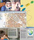
Children and cartography
Eye-tracking and cartography
Analytical hillshading
Spatial Information Systems applications
Journal reviewer
Aeichoros
Geographies
Technica Chronika
Spatial Science
The Journal of Maps
Research projects
1983-84 Ministry of Environment Planning and Public Works
The development of the cartographic symbols for the Operation of Urban Reformation
1984-85 Public Oil Company
Gravimetric and magnetic research on the region of Aitoloacarnanea
1985-86 Public Oil Company
Processing of gravimetric and magnetic data of Zakynthos
1991-92 Municipality of Athens
The development of a GIS representing the road network of the city of Athes (Senior researcher)
1992 GSRT
Methods for the preservation, management and exlpoitation of mountainous regions. The case of Crete island
1992-94 G.S.R.T. - Goulandri Physical History Museum
The production of a relief map of Greece
1994-97 European Community Commission - General Directorate XII
Atlas of wave energy resource in Europe WERATLAS - Project No 936335 (JOULE II)
1994-98 Ministry of National Defence
A comprehensive study of the hydro-acoustic characteristics of the Aegean Sea
1995-98 Ministry of Environment Planning and Public Works
Digital representation of the national road network (Senior researcher)
1996 Ministry of Environment Planning and Public Works & Municipality of Athens
Methods for resolving problems related to the center of the city of Athens wayfarers
1998-99 EuroSTAT - GISCO
Ref: 8728003, LOT5. Cartography
1999-00 EuroSTAT - GISCO
Ref: SOEC9728001, LOT5. Cartography. Map design
1998-00 Ministry of Environment Planning and Public Works
Evaluation of the north road network of the Crete island from Kasteli to Setea (Senior researcher)
1999 Cadastral and Cartography Service of Greece
Design and production of basic topographic map series of scale 1:25,000 (Senior researcher)
2000-01 Ministry of Culture
Development of contemporary surveying and photogrammetric methods for
the documentation and digital representation of byzantine monuments. The
case study the Daphne abbey
2001-02 Ministry of Environment Planning and Public Works
The incorporation of of the digital national road netwaork data in the frame of the ArcView software (Senior researcher)
2002 Leonardo da Vinci II - Mobility Program of D.G. XXII of European Union
Equalisation and development of the Geographical Information Systems
academic curriculum, University of Architecture, Civil Engineering and
Geodesy of
Sofia – National Technical University of Athens
2003-04 Programs of Basic Research - N.T.U.A. (Project Thales)
On the evaluation of selectivity of visual variables (Senior researcher)
2004-06 Programs of Basic Research - N.T.U.A. (Project Protagoras)
Develpoment of methods for detecting critical points on cartographic lines (Project manager)
2007-09 Ministry of Interior Affairs - Τechnical Chamber of Greece
Development of a GIS software for the representation of the built environment and its seismic vulnerability (Project manager)
(Interview broadcast Reportage Plus - ERT Digital on 24/12/2009)
2008-10 Programs of Basic Research - N.T.U.A.
Cartographic generalization of natural occuring lines based on visual perception (Project manager)
2011-13 TEMPUS IV
Highway Design and Management: Curricular Reform for Russian Federation
- Design and Implementation of Higher Education Master Courses in
Russia (Senior researcher)