|
Introduction
The
topic of children and mapping is a special subject within the broad
area that examines the ways people see and interpret maps. Children are
a special case of map users for two reasons. The first one pertains to
the relation between the development of children’s conception of space
and that of cartographic understanding. The theories of the children’s
spatial development, mainly deriving from psychological studies, have
provided the theoretical basis for approaching the way children use
maps. The second reason is the educational perspective of school maps
and atlases. Most elementary or high school textbooks contain a large
number of maps, mainly the textbooks related to geography and
humanities courses.
Among the various kinds of maps that
children are exposed to, school atlases are the most noticeable
examples, being traditional educational tools that help children
acquire spatial knowledge and mapping skills. Their origins are traced
in 1697, as part of an atlas published by Louis Courcillon de Dangeau.
In 1753, an atlas by the great mathematician Leonard Euler was one of
the earliest German atlases explicitly made for use in schools. From
the beginning of the nineteenth century, school atlases were
systematically produced in Europe and North America. In our
technological era, the atlas form has been changed and consists of
packages, which are electronic atlases both software and spatial data,
and characterized by various degrees of interactivity.
At the beginning of the 1980s, a discussion started on how to approach
maps from the point of view of children. It was the beginning of a new
perspective into cartographic research, approaching the meaning of maps
from the user’s viewpoint. The next three decades were productive as
far as the theoretical and experimental work done in this area is
concerned. Children and mapping became a research topic in the fields of
psychology, geography, education, and cartography. Children’s
understanding of maps has been approached from different theoretical
perspectives: the nativist views, Piaget’s theory, Vygotsky’s theory,
and the cognitive perspective. Depending on the theory they are based
on, the research and experimental studies in cartography can
accordingly be distinguished as nativist, Piagetian, developmental (or
neo-Piagetian), culturalist, and cognitive. Many psychological studies
have focused on spatial cognition and mental representation of space,
and, as a consequence, maps have been used in these studies as means of
accessing children’s spatial thinking. Research on this topic from a
strictly cartographic perspective has been less forthcoming and
nonsystematic. So, there is a lot of research evidence concerning
preschool and early-primary-age children’s spatial thinking with
large-scale maps, though the evidence is rather limited on issues such
as: children’s understanding of cartographic concepts, the development
of spatial thinking with small-scale maps, how secondary school
children deal with maps, the kind of maps that are more effective for
children, the kind of maps children prefer, and the actual contribution
of computer mapping to geographic education.
The following paragraphs summarize the theoretical perspectives of
cartographic understanding, give some research evidence on the
development of understanding spatial representations, refer to the
basic characteristics of maps and the evidence as regards the
children’s development of associated concepts, and, in closing, address
the contribution of computer technology in children’s dealing with maps. |
Development of Cartographic Understanding
The Nativist Approach
The
first one, the nativist, posits that cartographic understanding is
innate. Three kinds of argument have been advanced for this
perspective. The first one comes from a particular view concerning
evolutionary development, according to which much of the structure of
human mind is innately specified, evolved through natural selection
during the evolutionary history of the species. The second argument in
support of this view is based on conclusions from experimental studies,
which claim that children develop mapping abilities at a very early
age, before receiving any cartographic education, and also, the mapping
abilities expressed by people in early stages of human history. The
maps, made 5000 years ago, suggest that all people develop an
understanding of the geographical space as well as the ability of
representing it through available materials. A third argument comes
from a 1986 study of the performance of a 4 year-old girl, blind from
birth, who could encode a tactile map and navigate between objects in a
room. The girl demonstrated an understanding of the correspondence
between the map and real space, even though she had no experience
either with the space or with maps. But, it has been argued that this
is just one case, while other studies suggest that blind children show
delays in spatial abilities.
Of support to this perspective are
similar views that have been expressed about the knowledge of language.
Darvine in 1871 was the first one to argue that language is an instinct.
Almost 100 years later, in 1965, Noam Chomsky, based on linguistic
analyses, argued that human language is a biological object, internal
to the human mind/brain, and the knowledge of language is
individualistic. Chomsky’s ideas had a great influence on linguistics
and cognitive science. Following Chomsky’s views, Steven Pinker argued
in 1994 that language is an instinct. Among other scholars, Chomsky’s
ideas have been also disputed from George Lakoff, who along with Mark
Johnson in 1980 argued that human language is not entirely a genetic
innovation, but rather central aspects of language arise through
evolution from the neural systems that are present in nonhumans. A
central point of Lakoff ’s ideas is that the mind is inherently
embodied, and thought is mainly unconscious. In 1987, Lakoff expressed
his belief that humans’ abilities to conceptualize the world are
grounded in human-environment interaction. So, he claims, reason is not
an essence that separates humans from nonhumans, but it is an essence
that places all on a continuum.
There have been several counter-arguments to the nativist approach to
map understanding. One is that the theory cannot explain why there are
many adults having difficulty in map reading. Another is that many
researches concluded that engagement with maps at an early age does not
necessarily mean that children can understand cartographic concepts. On
the contrary, there is evidence that map understanding progresses
slowly and gradually from easy to difficult tasks. The productive
result from this perspective is evidence that children can have some
engagement with maps at an early age and can be introduced to
cartographic concepts, starting from easy to more difficult ones. Neural
studies in the first years of twenty-first century give evidence for
continuity between mental capacities found in humans, such as
attention, memory, and learning, and those of other species of
primates, thus giving new potential to the nativist theory.
Piaget’s Theory
The
second perspective accepts that cartographic understanding follows the
stages of intellectual development. Jean Piaget’s theory on psychology
of intelligence and Jean Piaget’s and Barber Inhelder’s theories on
child’s conception of space and child’s conception of geometry
determined the research on maps and children for almost three decades
(from the 1970s and afterward).
Piaget and Inhelder proposed that children’s environmental adaptation
develops in a sequence of coherent and qualitatively different stages:
the sensorimotor, the preoperational, the concrete operational, and
the formal operational. In the sensori-motor stage, children (from
about birth to 2 years) do not have any mental function, and only at
the end of this stage develop inner representations of the outside
environment. At the preoperational stage, children (from 2 to 7 years)
cannot focus their thinking on more than one thing. They perceive space
from an egocentric point of view and understand only topological
spatial relations. At about age 3-4, they can recognize shape as the
first topological spatial relation, also open and closed figures, but
they cannot differentiate between closed figures (circle, square). They
are not able to form a straight line. By about age 5-6, they begin to
discriminate straight and curved lines, sizes of lines and angles
(Euclidean properties), but, they cannot organize landmarks in an
objective spatial whole, rotate a plane 180 degrees, describe changes
of position, and reconstruct a route in reverse direction. At this
stage, there is nonconservation of overall distance, and only at the
end of this stage children start to learn how to measure,
qualitatively, without unit iteration. At the concrete operational
stage, children (from about 7 to 11 years) can use operations (mental
processes) which enable them to classify, arrange objects in series,
and understand projective properties of space. However, children of
about 7-9 years are unable either to coordinate a system as a whole, or
to describe a route. At a mean age of 7.5, they show conservation of
distance between two objects, and at a mean age of 8.5 they are capable
of one-dimensional measurements in an operational form and empirically
discover the two-dimensional measurement. They also show conservation
of area. Children of about 9–11 years can coordinate landmarks and
changes of position, they can construct a topographical schema in a
coordinate system, and they have a full appreciation of two-dimensional
and three-dimensional measurements. Finally, at the formal operational
stage (above 11–13 years), children are capable of more abstract and
logical thinking, they are able to understand Euclidean properties of
space, they establish relations between lines and areas, and they
understand volumes of objects in relation to the surrounding space.
At each stage, children’s mental abilities are rather stable. The
mental structures of knowledge and understanding are developed into new
ones because of new experiences and adaptation to new information. In
recent years, many psychologists reject the authenticity of Piaget’s
theory and mainly the idea of discontinuous stages of development.
According to them, many skills seem to develop more gradually and
continuously. The distinction of spatial relations in topological,
projective, and Euclidean is criticized as not being helpful to an
analysis of spatial thinking. The theory is criticized for being
focused on the level of the individual, ignoring the important role of
the social processes involved in cognitive development. Another point
of argument is the implication of Piaget’s theory that adults are
accurate in spatial understanding, which seems to be wrong.
Piaget’s theory had a great influence on the research on children’s
mapping abilities. The Piagetian approach to cartographic understanding
accepts cognition as the basic factor in the development of mapping
competence. Children actively construct their knowledge about maps.
This construction of knowledge is a continual interaction between
children and related experience. This is a fundamental issue which
determined both theoretical and experimental work on this topic.
Children’s perceptual abilities, at each stage, were a guide for the
introduction of cartographic concepts gradually and according to the
degree of difficulty involved. Piaget’s experimental work using graphic
representations and spatial models greatly helped predict how children
conceptualize space through maps. The results of many experimental
studies on what children dealing with maps can understand do agree with
Piaget’s theory, while other experimental studies suggest that children
can do more with maps than what Piaget’s theory suggests. In 1989, Lyn
Liben and Roger Downs based on the Piagetian approach -although
critically- proposed a developmental approach to children’s
understanding of maps. Based on many experiments in the 1990s, they
concluded that map understanding is a complex procedure that develops
gradually depending on the cognitive level and experience of the
individual, and it has to be approached both from a developmental and a
cartographic perspective. They also argue that children show competence
in a few mapping activities at an early age, but cartographic
competence improves slowly in tasks concerning more advanced spatial
thinking.
Vygotsky’s Theory
The
third perspective considers the social factor as playing a central role
in cartographic understanding. Among the psychologists that criticize
the individualism of Piaget’s theory is Lev Vygotsky. His theory on
learning and cognitive development, as expressed in his work on thought
and language and mind in society, has offered the theoretical basis in
studies on cartographic understanding in recent years. The relation
between the biological roots of behavior and the human activities in
the social environment is a critical issue in every theory of
development. Vygotsky used a key point in his approach of this
relation, mainly, the functional system of learning, which
differentiates the concepts of learning as defined in other theories.
According to him, there are two kinds of concepts: the spontaneous
results of everyday experience and the scientific results of systematic
school learning. The first ones are concrete and unsystematic, while the
second are systematic and hierarchically structured. There is a gap
between spontaneous concepts (children’s own learning) and scientific
concepts (taught by teachers), which is wide in very young children and
is gradually bridged after systematic learning. Scientific concepts are
easier to learn, and it is better for children to formalize concepts in
school with the help of skilled learners before experiencing them
unsystematically. So, according to Vygotsky, school must play a central
role in cognitive development.
Investigations in 1989 and 1991
demonstrated that guided participation may be important in the
development of spatial thinking. In experiments in 1991, children were
able to plan routes on a map more effectively when collaborating with
adults. In experimental studies in 1998, children of 12-13 years of age
working in groups showed a slightly better understanding of
cartographic concepts than the ones working individually. In 2000, it
was admitted that Vygotskian views have been prominent in research on
spatial competence and also in a study in 2003, it was said that
collaborative teaching in solving cartographic problems needs further
development. But it has also been argued that Vygotsky’s theory
overemphasizes the role of the social environment in the development of
mind.
The Cognitive Perspective
The
fourth theoretical perspective to cartographic understanding is based
on theories of cognition that developed the last decade of the
twentieth century and is growing at an exponential rate. In the context
of developmental cognitive neuroscience, studies from various
disciplines give evidence about brain processes and resulting mental
functions. The use of electrophysiological recording systems to record
the human brain opened new horizons toward understanding cognitive
development. These brain-scanning techniques opened up the possibility
to view the brain in action and localize the regions of the brain
activated during different activities. Several regions appear to be
devoted to spatial thinking, and it is concluded that these regions
develop in very early childhood, contrary to what was believed. Based
on these findings, suggestions have been expressed for starting
cartographic literacy in kindergarten.
In the context of the
cognitive perspective, there is another approach to cartographic
understanding based on the theory of information processing.
Informationprocessing approaches (which first appeared in the 1960s)
use models of the human cognitive system based on computer operations,
where the hardware is the perceptual and cognitive human system (eyes
and brain), and the algorithms are the mental activities by means of
which information is processed (perceived, encoded, stored, and used
for problem solving). The major goal of this psychological approach is
to describe the nature of thought, how the human mind represents and
handles information, and how knowledge is processed and organized. The
developmental changes are proposed to be gradual and continuous. What
children know is not that important. Instead, of importance is how
cognitive processes change with age and experience. Children are seen
as being active in interactions with the environment, because they
perceive objects and events and then remember and draw inferences from
them.
The cartographic perspective on the information-processing theory is a
new approach. The earlier cognitive models related to cartographic
concepts appeared around 1985. Since then, knowledge structures of
map-related information have been proposed, and in several studies
models of cognitive structures have been used in experiments related to
children’s activities with maps. The strength of the approach is that
it offers insight into children’s thinking as to how they handle
information while using maps. On the other hand, it approaches
understanding from the individual point of view, ignoring the social
parameters involved in this process.
Recent Views
The
aforementioned theoretical approaches to cartographic understanding
differ mainly as to the point they consider as dominant in the
development of spatial thinking. This consideration determines not only
each theoretical position but also the experimental work on which it is
established. As to what approach has to be followed in future research,
the prevailing view is that there is no single scientific approach as to
how children learn with maps. In order to face the educational map
material from a critical point of view and maps as means that produce
knowledge, the approach has to be holistic, taking into account the
fact that children are individuals who perceive the geographical space
and its representations through their senses, and at the same time,
they are members of a society, inevitably influenced by their social
environment as well as by the educational procedures. Such an approach
to spatial development has been proposed by Nora Newcombe in 2000. She
advocates that her approach: encompasses nativism by considering early
infancy as the starting point for spatial development but denying that
the competencies of infants are so fundamental to spatial development
as nativists argue, is interactionist without being Piagetian, and it
encompasses interactions of the child with the skilled adults but
denying their dominant role in development. In 1995, MacEachren had
proposed a similar holistic approach to map understanding. He considers
maps as spatial representations and contends that the concept of
representation is fundamental to all approaches that can be taken to
cartography. In his detailed analysis, he approaches maps at multiple
levels: lexical, semiotic, cognitive, and social. |
Understanding Spatial Representations
Using Models
According
to Piaget, children of about 7 years of age start to appreciate the
model as a representation. Experimental studies in 1991 with children
of ages between 2.5 and 3 years found that children appear to
appreciate the correspondence between a room and a model, having more
success when the room is familiar to them and when the model is a
photograph or a drawing. Another study in the same year suggests that
very young children recognize just unique objects and their
representations in the models rather than fully appreciating the model
as a representation. Other experiments in 1997 indicate that children
from about the age of 3 are able to use a model to find a location. In
2000, a review study concludes that children after 3 years possess the
idea that models are tools of thought, suggesting that the use of
models by children needs initial support.
Using Aerial Photographs
Aerial
photographs are considered means of introducing children to spatial
representations. Without being abstract and symbolic representations as
maps are, large-scale photographs remind one of geographical space. By
photo-interpretation procedures, children can be introduced into the
concept of looking at the Earth from above. The results of the rather
few experimental studies with preschoolers using photographs are
contradictory. In 1970, the results of the experiments with 5-7
year-old children showed that all children were able to understand that
the photograph was the view of a landscape from above, but they could
recognize just a few features. In 1980, experiments with 3-5 year-old
children concluded that they were able to recognize many features on
the photos. Contradictory results have been derived from studies with
preschoolers in 1991. Very young children seemed to interpret
successfully very large-scale photographs of space familiar to them, as
was found in two studies in 2002 and 2003. The results suggested that
young children view aerial photographs as a collection of features and
not as a representation of an area. In experiments in 1971 with older
children of ages 6-11 years,it was concluded that below age 9, children
had problems in recognizing features, and only the older ones of ages
9-11 years seemed able to identify many characteristics. Even then,
they were able to identify mainly the familiar ones and the ones whose
image in the photograph looks like their view from the ground. However,
they find it difficult to identify the area presented on the photo.
Difficulties seem to appear when using small-scale photographs. An
experimental study in 1983 showed that many students aged 16 years
could not successfully relate small-scale photographs and corresponding
maps. The same results were found in another study in 1979, in which
high school students aged 15-16 years had difficulties in relating
oblique aerial photograph with the map. It has been argued in 2006 that
more systematic experimental research is required on this issue.
Using Maps
In
the context of the developmental approach to cartographic
understanding, the understanding that a map is a spatial representation
can be distinguished as accomplished at two levels. At one level, the
so-called holistic, children understand the relationship between the
map as a whole and the whole of the real-world space to which it
refers. At another level, the so-called componential, children
understand the symbol–referent relationship for each individual symbol.
At the componential level, two things have to be understood: the first
one is the geometric correspondence between the position of each
individual symbol on the map and the location of the referent feature
in the real space. The second is the representational correspondence,
which refers to the symbolic representation of feature characteristics
as recorded in the legend. Experimental studies in 1987 and 1996
suggest that children from about the age of 4 understand that maps
represent spatial information, but it seems that they do not have a
full understanding of the representational correspondence between the
map and the represented space. As was found in a study in 1996,
children about 8 years-old think that the map is only a small-scale map
used for finding ways and unknown places. Gradually, older children
understand that the term map includes many different kinds of spatial
representations. At the componential level, there is evidence from
experiments in 1979 that children from the age of 3 years can use
information from a simple map in order to identify a location. Other
experiments in 1989, 1989, and 1996 concluded that kindergarten
children can indicate their own location on the map but have difficulty
in locating other locations. Moreover, they have significant difficulties
in location and orientation tasks when the map is unaligned to the
environment that it represents. The orientation task using unaligned
maps is difficult, and only children about 10-11 years-old succeeded in
it. Representational correspondence appears to be achieved by about 6
years of age, as indicated in experiments in 1997. Other studies in
1979 and 1994 give evidence that 4 year-olds appear to be able to
understand representational correspondence in the case of pictorial
symbols. The lack of systematic investigation of early understanding of
symbols has been mentioned in many recent literature reviews. |
Understanding the Basic Characteristics of Maps
The
achievement of cartographic understanding has, as a prerequisite, the
understanding of the basic characteristics of maps. Scale, map
projections, generalization, and symbolization are common to every map
and are considered as basic characteristics of maps. Since map literacy
is not systematically included in the school curriculum, there are no
definite and clear results referring to children’s understanding of
these basic map concepts. On the other hand, the results of
experimental studies give some evidence as regards children’s
development of concepts associated with the map’s basic characteristics.
Scale
Map
scale is the ratio between the dimensions on the map and on those of
reality. According to Piaget, understanding scale requires the
understanding of proportionality, concepts achieved at the formal
operation stage. Experimental studies in 1999 show that children around
3-4 years-old are able to encode proportional distance. Other
experiments in 1996 show that 7 year-old children make substantial
errors in map-scale tasks. Also, in another study in 1995, 10 year-old
children perform worse than children of 11-13 years-old in map-scale
tasks. In 2000, a review study of the above experiments suggests that
the contradiction of the results leads to a reconsideration of Piaget’s
view that scale depends on acquisition of proportionality. Scale is
indicated on maps both in numerical and graphical representations.
Graphic scale representations are more useful for young children in
distance-estimation tasks. In maps addressed to children, different
graphic scale representations support different learning levels. In a
study in 1971, difficulties and misconceptions were identified in tasks
involving children’s use of graphic scale such as: confusion by the use
of different graphic scales in different maps, difficulty to measure
long distances as easily as short ones, inability to understand that
the outcome of the measurement is a true distance on the ground, and
having problems in countries where the units of measurement are
different from those on the map scale.
Map projections
Through
map projections, the spherical surface of the Earth is transformed into
a plane. A map projection is a mathematical relationship of
geographical coordinates (φ, λ) and plane coordinates (x, y). Whatever
is the mathematical relationship applied to the transformation process,
distortions are inevitable. The distortions of the geometric
relationships on the sphere (distances, areas, angles, directions),
when projected onto the plane, can be controlled by a suitable choice
of projection.
Understanding map projections involves
constructing the image of the graticule on the map. Children must be
able to visualize the form of the graticule and the way it looks from
different perspective views. Having achieved this knowledge, children
are able to evaluate projections by comparing the geometry of the
graticule as it is on the spherical Earth with the grid on the map.
Gradually, they come to understand the effects different
transformations have on the representation of landmasses as well as the
importance of choosing the best projection for a particular map.
Children of around 9-11 years of age (depending on different school
curricula) are introduced to the concepts of the spherical Earth, the
equator, the meridians and parallels. According to Piaget’s views,
children are able to use coordinates at about 8 years of age. But
experiments in 1965 report that children of 10-14 years-old have
difficulty in using coordinates in mapping tasks. The use of dynamic
representations of the globe and its perspectives from different points
of view as well as its transformation to a plane through various kinds
of map projections can be a strong educational tool for introducing
children to the concepts of map projections.
Generalization
All
maps are abstractions of the real world. As the scale gets smaller, the
map content gets less. The information portrayed on maps has been
chosen according to the scale and the purpose of the map. The chosen
information has been subject to the generalization processes, which
are: classification (order of features by their attributes),
simplification (portrayal of important feature characteristics and
elimination of details), exaggeration (enhancement of important
characteristics), symbolization (graphical coding of information), and
induction (inferences from the interrelations among the features on the
map). All the processes of generalization are done by the cartographer,
except that of induction for which it is the user who makes logical
extensions of the portrayed data, so it depends a lot on the
symbolization. The extent to which the generalized information
presented on maps affects the way children interpret maps has not been
studied systematically. From the few experimental studies in 1972,
1980, and 1981, there is evidence that children of primary and also of
secondary school make misinterpretations, thinking that what is
presented on a map is all that exists in the real world. A review study
in 1998 recognizes the need for children’s introduction to the concept
of generalization and to the processes involved in it. Generalization
is a key step toward successful map interpretation.
Symbolization
Maps
use symbols that stand for the features of the real world they portray.
Since 1967, when Jacques Bertin introduced a semiotic approach to
cartographic symbolization, cartographers have followed a systematic
symbol design, developing typologies of symbol categories. The visual
variables (shape, size, orientation, hue, value, chroma, pattern, and
texture) were the basis of symbol design assigned to represent
quantitative and qualitative variations of the data represented on
maps. Although the use of visual variables in symbol design is
practically a standard procedure, it has not been considered as a
prerequisite knowledge for map use.
Relatively little is known
about how young children interpret symbols in maps. According to
Piaget, children are able to recognize shape at sometime after 3 years.
In 2000, another scholar underlined the fact that children with
appropriate guidance could appreciate the symbol-referent relation
earlier. It is argued in many experiments that children have greater
difficulty in understanding the geometric correspondence than the
representational one. In 1996, experiments found that kindergarten
children show great variation in symbol identification. Children are
able to identify shape variable and show difficulty in color naming.
They easily identify both pictorial and abstract line symbols, but they
show difficulty with point and area symbols. In other experiments in
1996, very young children aged 5-7 years found pictorial symbols
attractive and easier to interpret. Many of them were able to identify
abstract symbols using a legend. Size is easily identified. The
understanding of color as a variable is cognitively complex, since it
requires matching color differences with object characteristics, and
this ability improves by age. The level of knowledge (experience) and
the level of development (verbal ability and amount of attention) are
mentioned as responsible factors.
Elementary school students are gradually exposed to maps that apply
abstract symbols and the use of legend. Matching symbols between the
legend and the map involves holding the symbol characteristic in
memory, so this task develops gradually. Experiments in 1984 show that
children understand qualitative symbols first, and quantitative ones
later. Size is easily identified as a variable, but it is difficult for
children to compare the size of symbols whose area is proportional to a
quantity. School atlases addressed to children older than 11 years
comprise thematic maps representing quantities that occur at points,
lines, or areas. When quantities occur over an area, a statistical
surface is created. The concepts of the statistical surface, of ratio,
and proportionality are very important in thematic mapping and a
prerequisite knowledge for understanding thematic maps like dot maps,
choropleth, and isarithmic common to all school atlases. Experiments in
2003 show that students even of third and fourth year of secondary
school do not fully understand the concepts of ratio and
proportionality.
Relief
Relief
can be represented in maps by various methods, such as symbols of
stylized form (appear not only on early maps, but also today on maps
addressed to very young children), hachuring (lines representing the
greatest slope), hill shading, layer tinting (hypsometric coloring),
and contouring. Relief can also be represented through perspective
pictorial maps (block diagrams, oblique views, and schematic maps).
There are two aims of relief representation: first, the visualization of
relief by the user when seeing the map as a whole and, second, the
interpretation of elevation data. The methods of representation that
are effective in the visualization task have poor results in the
interpretation tasks. Contouring gives measurable data, but is poor in
visualizing. Hill-shading gives a realistic visual representation but
nonmeasurable data. Recently, topographic maps represent relief by
using contours and hill shading, and the result is very effective.
According to Piaget, children are able to understand the relief
representation not earlier than 9 years of age and the concept of
contouring not earlier than 11 years. In experiments in 1979, it is
argued that only at the age of 11 can children interpret simple
landforms. But even younger secondary school students show difficulties
in height estimation and relief interpretation in cases where contours
are not closed. Their performance improves with maps in which
contouring is combined with layer tinting. Experiments in 1983 argue
that limitations on language development seem to be a serious problem
in understanding the relief on maps, since children do not know the
geographical terms. The understanding of contours appears to be a
difficult task as well. Slope estimation seems to be the most difficult
task, even for 14 year-olds, as reported in studies in 1979 and 1989.
For younger children, three-dimensional models seem to be helpful for
an introduction to landscape surfaces, as reported in experiments in
1997. Three-dimensional representations and pictorial maps are more
effective for primary school students to visualize landforms. |
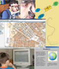
Children as Map Users in the Information Technology Era
Cartography
at the beginning of twenty-first century is facing a technological
revolution due to the widespread use of electronic media and especially
of computers and information technology. In many countries, individuals
have access to a computer usually connected to a worldwide network
everyday. Such a technological advance not only affects the technical
frame of cartography, but it also changes decisively the relation
between cartography and society. During the long history of
cartography, the latter faced significant technological revolutions that
changed the methods of map construction dramatically. But in every
case, the cartographic processes needed specially trained staff
(cartographers) in order to be performed. As a result, the knowledge of
how to construct a map was related to a very small section of the
society, that is, the cartographers. The existence of such advanced
technological tools is transforming any member of the society, and
especially children, into a cartographer by offering electronic systems
able to construct any kind of map. Indeed, children have a more
privileged place by being familiarized with the use of the computers.
Children can easily convey the knowledge acquired from playing a
computer game into an effective construction of a map. Two issues are
important for the children’s proper assimilation of the present
technology. The first one is related to the dramatic change of the
available educational tools provided by information technology.
Software packages provide the ability to simulate several spatial
phenomena (construction of models, walkthrough, and fly-through) and to
construct virtual worlds and examples, while at the same time their
function is characterized by interactivity. Thus, using electronic
media, children can be exposed to map skills and to map concepts (i.e.,
generalization, map projections, and spherical Earth) by means of
various and effective communicative ways. The second issue refers to
children as mapmakers. In the past, children were constructing an
analog map of a continent, for example, by tracing (from a published
map) the coastline on a piece of paper. With a computer, they can
construct a detailed map of the same continent by retrieving data from
a spatial database and symbolizing various features in alternative
colorful ways. A critical question is raised here as to whether these
maps made by children are effective in developing cartographic
knowledge, or are they just drawings. Specialists on children and
mapping persistently ask for map literacy. |
Further Reading
Carswell, R. B., Leeuw, G. A. and Waters, N. M. (eds.) (1987). Atlases for schools. Cartographica, 24/1, Monograph 36.
Castner, H. W. (1990). Seeking New Horizons: A Perceptual Approach to Geographic Education. Montreal and Kingston: McGill-Queen’s University Press.
Cohen, R. M. (ed.) (1985). The Development of Spatial Cognition. Hillsdale, NJ: Lawrence Erlbaum.
Downs, R. M. and Stea, D. (eds.) (1973). Image and Environment: Cognitive Mapping and Spatial Behavior. Chicago, IL: Aldine.
Gersmehl, P. J. (2005). Teaching Geography. New York: The Guilford Press.
Golledge, R. G. (ed.) (1999). Wayfinding Behavior: Cognitive
Mapping and Other Spatial Processes. Baltimore, MD: Johns Hopkins Press.
Kraak, M. J. and Brown, A. (2001). Web Cartography. London: Taylor and Francis.
Kraak, M. J. and Ormeling, F. J. (1996). Cartography: Visualization of Spatial Data. Harlow: Addison-Wesley-Longman.
Kosslyn, S. M. (1994). Image and Brain: The Resolution of the Imagery Debate. Cambridge, MA: MIT Press.
Liben, L. S. and Downs, R. M. (1989). Understanding maps as symbols:
The development of map concepts in children. Advances in Child Development and Behavior 22, 145-201.
MacEachren, A. M. (1995). How Maps Work. Representation, Visualization, and Design. New York: The Guilford Press.
Newcombe, N. S. (2000). Making Space: The Development of Spatial Representation and Reasoning. Cambridge, MA: MIT Press
Wiegand, P. (2006). Learning and Teaching with Maps. London: Routledge.
Wood, C. H. and Keller, P. C. (eds.) (1996). Cartographic Design: Theoretical and Practical Perspectives. Chichester: Wiley |
Edited by V. Filippakopoulou and B. Nakos
|