Karmas A., Tzotsos A., Karantzalos K., 2015. Big Geospatial Data for Environmental and Agricultural Applications, Yu and Guo (eds.), Big Data Concepts, Theories and Applications, Springer International Publishing Switzerland.
Karantzalos K., Bliziotis D., Karmas A., 2015., A Scalable Geospatial Service for Near Real-Time, High-Resolution Land Cover Mapping, IEEE Journal of Selected Topics in Applied Earth Observations and Remote Sensing, Special Issue on "Big Data in Remote Sensing", 10.1109/JSTARS.2015.2461556.
Karmas A., Tzotsos, A., Karantzalos K., 2015. Scalable Geospatial Web Services through Efficient, Online and Near Real-time Processing of Earth Observation Data, IEEE Int. Conf. on Big Data Computing Service and Applications.
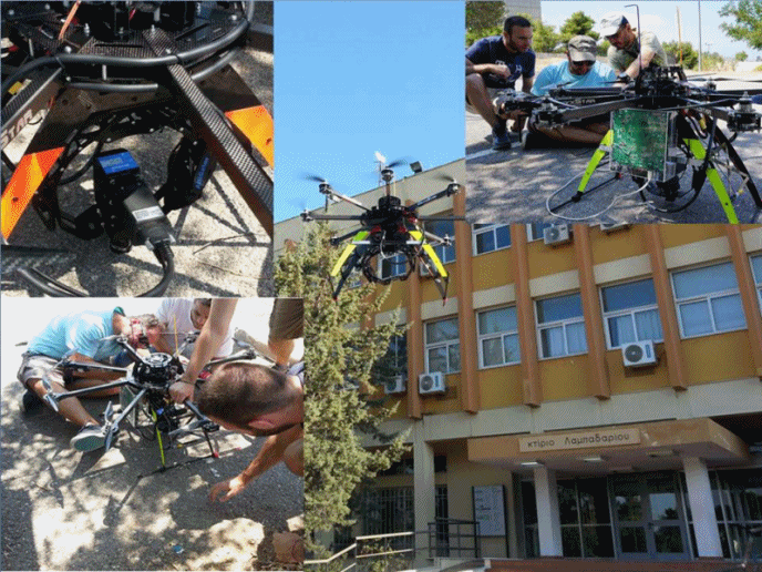
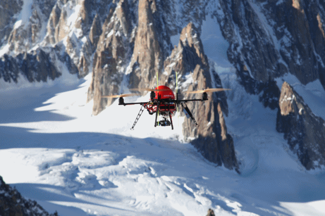
K. Karantzalos, P. Koutsourakis, I. Kalisperakis, and L. Grammatikopoulos, 2015. Model-based Building Detection from Low-Cost Optical Sensors Onboard Unmanned Aerial Vehicles, ISPRS International Conference on Unmanned Aerial Vehicles in Geomatics, ISPRS UAV-g2015 (Volume XL-1/W4), pp.293-297.
I. Kalisperakis, Ch. Stentoumis, L. Grammatikopoulos, and K. Karantzalos, 2015. Leaf area index estimation in vineyards from UAV hyperspectral data, 2D image mosaics and 3D canopy surface models, ISPRS International Conference on Unmanned Aerial Vehicles in Geomatics, ISPRS UAV-g2015 (Volume XL-1/W4), pp.299-303.
Karmas A., Tzotsos, A., Karantzalos K., 2015. Vakalopoulou M. and Karantzalos K., 2013. Automatic Co-registration of Frame Hyperspectral Data from UAVs , In: Bendig, J., Bareth, G. (Eds.): Proceedings of the Workshop ISPRS Workshop on UAV based Remote Sensing Methods for Monitoring Vegetation, 93-98, DOI: 10.5880/TR32DB.KGA94.13.
Karantzalos, K., 2015. Recent Advances on 2D and 3D Change Detection in Urban Environments from Remote Sensing Data, M. Helbich et al. (eds.), Computational Approaches for Urban Environments, Geotechnologies and the Environment 13, Springer International Publishing Switzerland, pp.237-272.
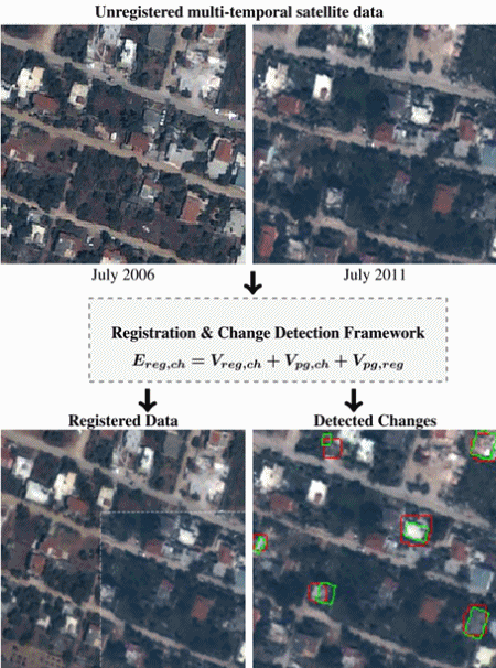
Vakalopoulou M., Karantzalos K., Komodakis N., Paragios N., 2015, Simultaneous Registration and Change Detection in Multitemporal, Very High Resolution Remote Sensing Data, IsEEE Computer Vision and Pattern Recognition Workshops, CVPRW'15, June 2015, pp.1-9.
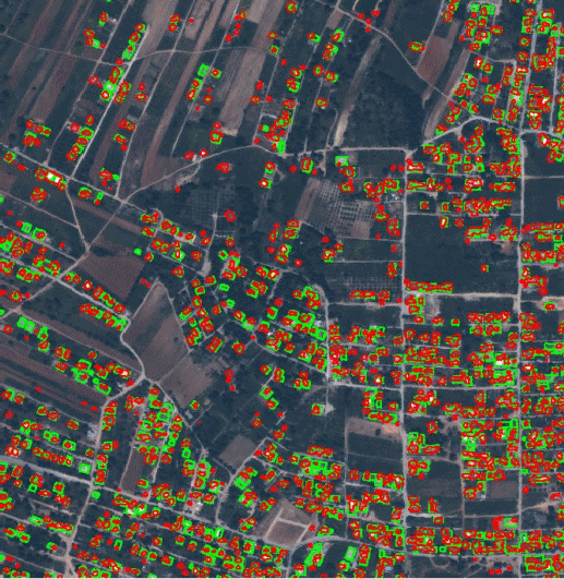
Karmas A., Tzotsos, A., Karantzalos K., 2015. Doxani G., Karantzalos K., Tsakiri-Strati A., 2015. 2015, Object-based Building Change Detection from A Single Multispectral Image and Prior Geospatial Information, Photogrammetric Engineering & Remote Sensing, Vol. 81, No. 6, pp. 481–489.
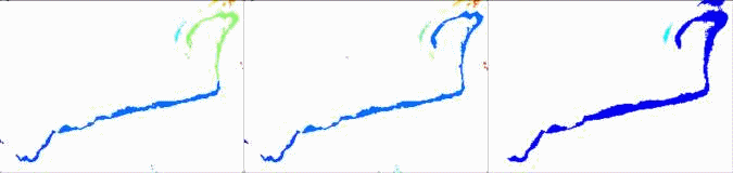
Kandylakis Z., Karantzalos K., Doulamis A., Doulamis N., 2015. Multiple Object Tracking with Background Estimation in Hyperspectral Video Sequences, IEEE Workshop on Hyperspectral Image and Signal Processing: Evolution in Remote Sensing (WHISPERS). .
Vakalopoulou M. and Karantzalos K., 2014. Automatic Descriptor-based Co-registration of Frame Hyperspectral Data, Remote Sens., Vol.6(4), pp.3409-3426, doi:10.3390/rs6043409.
Karantzalos K., 2008. A 4D Morphological Scale Space Representation for Hyperspectral Imagery, International Archives of the Photogrammetry, Remote Sensing Spatial Information Sciences, vol. XXXVII, pp.127-132, ISSN 1682-1750.
Platias, Ch., Vakalopoulou, M., Karantzalos, K., 2016. Automatic MRF-based Registration of High Resolution Satellite Video Data, ISPRS Annals of the Photogrammetry, Remote Sensing and Spatial Information Sciences.
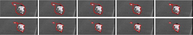
Kopsiaftis G. and Karantzalos K., 2015. Vehicle Detection and Traffic Density Monitoring From Very High Resolution Satellite Video Data, IEEE International Geoscience and Remote Sensing Symposium (IGARSS), 2015.
Papadomanolaki, M., Vakalopoulou, M., Zagoruyko, S., Karantzalos, K., 2016. Benchmarking Deep Learning Frameworks for the Classification of High Resolution Satellite Multispectral Data, ISPRS Annals of the Photogrammetry, Remote Sensing and Spatial Information Sciences.
Makantasis K., Karantzalos K., Doulamis A., Doulamis N., 2015. Deep Supervised Learning for Hyperspectral Data Classification through Convolutional Neural Networks, IEEE International Geoscience and Remote Sensing Symposium (IGARSS).
Vakalopoulou M., Karantzalos K., Komodakis N., Paragios N., 2015. Building Detection in Very high Resolution Multispectral Data with Deep Learning Features, IEEE International Geoscience and Remote Sensing Symposium (IGARSS).
Makantasis K., Karantzalos K., Doulamis A., 2015. Deep Learning-Based, Man-made Object Detection from Hyperspectral Data, International Symposium on Visual Computing (ISVC).
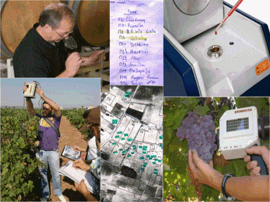
Kandylakis and Karantzalos, 2016. Precision viticulture from multitemporal, multispectral very high resolution satellite data, ISPRS Archives of the Photogrammetry, Remote Sensing and Spatial Information Sciences.
Karantzalos K., Karmas A., Tzotsos, A., 2015, RemoteAgri: Processing Online Big Earth Observation Data for Precision Agriculture, 10th European Conference on Precision Agriculture, pp.421-428, doi: http://dx.doi.org/10.3920/978-90-8686-814-8_52.
I. Kalisperakis, Ch. Stentoumis, L. Grammatikopoulos, and K. Karantzalos, 2015. Leaf area index estimation in vineyards from UAV hyperspectral data, 2D image mosaics and 3D canopy surface models, ISPRS International Conference on Unmanned Aerial Vehicles in Geomatics, ISPRS UAV-g2015 (Volume XL-1/W4), pp.299-303.
Karakizi C., Oikonomou M., Karantzalos K., 2015. Spectral Discrimination and Reflectance Properties of Various Vine Varieties from Satellite, UAV and Proximate Sensors, ISPRS Archives, Editors: G. Schreier, P. E. Skrovseth, and H. Staudenrausch, International Symposium on Remote Sensing of Environment (Volume XL-7/W3), pp.31-37.
Theologou, I., Patelaki, M., Karantzalos K., 2015. Can single empirical algorithms accurately predict inland shallow water quality status from high resolution, multi-sensor, multi-temporal satellite data? ISPRS Archives, Editors: G. Schreier, P. E. Skrovseth, and H. Staudenrausch, International Symposium on Remote Sensing of Environment (Volume XL-7/W3), pp.1511-1516.
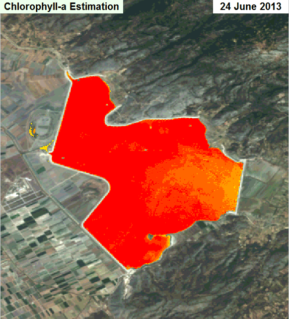
Theologou I., Kagalou I., Papadopoulou M.P., Karantzalos K. 2015. Evaluating Multi-temporal High Resolution Satellite Chlorophyll–α Maps in Sensitive Shallow Inland Water Systems: The Case of Lake Karla, World Congress of the European Water Resources Association (EWRA), Water Resources Management in a Changing World: Challenges and Opportunities, Istanbul, June 2015.
Karantzalos K., Sotiras A., Paragios N., 2014, Efficient and Automated Multi-Modal Satellite Data Registration through MRFs and Linear Programming, IEEE Computer Vision and Pattern Recognition Workshops, CVPRW'14, June 2014, pp.1-8. [slides]
Vakalopoulou M. and Karantzalos K., 2014. Automatic Descriptor-based Co-registration of Frame Hyperspectral Data, Remote Sens., Vol.6(4), pp.3409-3426, doi:10.3390/rs6043409.
K. Karantzalos, P. Koutsourakis, I. Kalisperakis, and L. Grammatikopoulos, 2015. Model-based Building Detection from Low-Cost Optical Sensors Onboard Unmanned Aerial Vehicles, ISPRS International Conference on Unmanned Aerial Vehicles in Geomatics, ISPRS UAV-g2015 (Volume XL-1/W4), pp.293-297.
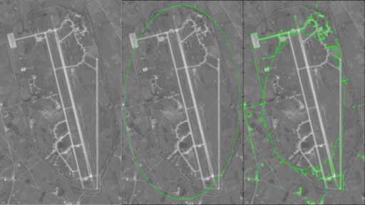
Karantzalos K. and Paragios N., 2010. Large-Scale Building Reconstruction through Information Fusion and 3D Priors, IEEE Transactions on Geoscience and Remote Sensing Volume 48, No.5, pp. 2283-2296.
Karantzalos K. and Paragios N., 2009. Recognition-Driven 2D Competing Priors Towards Automatic And Accurate Building Detection, IEEE Transactions on Geoscience and Remote Sensing, Volume 47, Issue 1, pages 133-144.
Karantzalos K., 2008. A 4D Morphological Scale Space Representation for Hyperspectral Imagery, International Archives of the Photogrammetry, Remote Sensing & Spatial Information Sciences, Com. III, pp.127-132.
Karantzalos K., 2009. Intrinsic Dimensionality Estimation and Dimensionality Reduction through Scale Space Filtering, IEEE International Conference of Digital Signal Processing, pp.1-6, doi: 10.1109/ICDSP.2009.5201196.
Karantzalos K. and Argialas D. 2008. Automatic Detection and Tracking of Oil Spills with Level Set Segmentation from SAR Imagery, International Journal of Remote Sensing, Volume 29, Issue 21, pages 6281-6296 (invited paper).
Karantzalos K. and Argialas D., 2006. Automatic detection of oil spills with level set segmentation technique from remotely sensed imagery, International Symposium of Remote Sensing, Korea, 2006, pp.126-129. ().
Karantzalos K. and N. Paragios, 2005. Implicit free-form-deformations for multi-frame segmentation and tracking, IEEE Variational and Level Set Methods in Computer Vision, Lecture Notes in Computer Science 3752, Springer, pp271-282, ISBN 3-540-29348-5.
Karantzalos K. and N. Paragios, 2005. Higher Order Polynomials, Free Form Deformations and Optical Flow Estimation, IEEE International Conference on Image Processing (ICIP’05), vol 3, pp.1280-1283, Genoa, Italy.
Karantzalos K. and Argialas D. 2009. A Region-Based Level Set Segmentation for Automatic Detection of Man-Made Objects from Aerial and Satellite Images, Photogrammetric Engineering and Remote Sensing, Vol.75, No.6, pages 667-678.