Correcting Refraction towards Accurate Aerial Image-based Bathymetry Mapping at Shallow Waters
Related publications
Correcting Image Refraction: Towards Accurate Aerial Image-Based Bathymetry Mapping in Shallow Waters
Panagiotis Agrafiotis, Konstantinos Karantzalos, Andreas Georgopoulos, Dimitrios Skarlatos
Remote Sens. 2020, 12, 322.
DepthLearn: Learning to Correct the Refraction on Point Clouds Derived from Aerial Imagery for Accurate Dense Shallow Water Bathymetry Based on SVMs-Fusion with LiDAR Point Clouds
Panagiotis Agrafiotis, Dimitrios Skarlatos, Andreas Georgopoulos, Konstantinos Karantzalos
Remote Sens. 2019, 11, 2225.
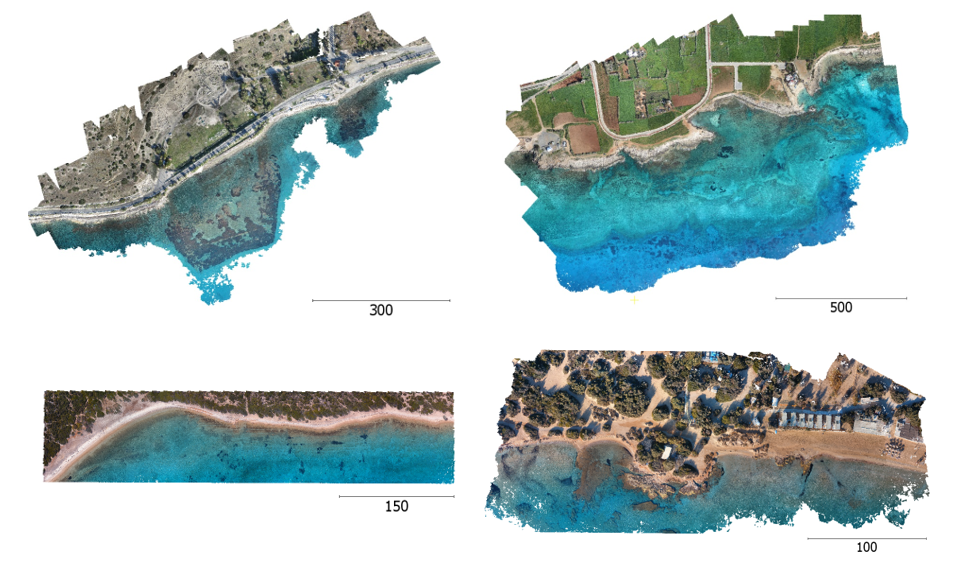
Shallow Water Bathymetry Mapping from UAV Imagery based on Machine Learning
Panagiotis Agrafiotis, Dimitrios Skarlatos, Andreas Georgopoulos, Konstantinos Karantzalos
Int. Arch. Photogramm. Remote Sens. Spatial Inf. Sci., XLII-2/W10, 9-16, 2019.
A Novel Iterative Water Refraction Correction Algorithm for Use in Structure from Motion Photogrammetric Pipeline
Dimitrios Skarlatos and Panagiotis Agrafiotis
Journal of Marine Science and Engineering 6(3), 77, 2018