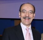
Short CV

| Name: |
CHARALABOS |
| Family Name: |
IOANNIDIS |
| Date of Birth: |
13 March 1959 |
| Place of Birth: |
Thessaloniki |
| Status: |
Married |
| Position: |
Professor NTUA |
Brief Description of Activities
| 2014 - today |
Professor at the Lab of Photogrammetry, School of Rural, Surveying and Geoinformatics Engineering, NTUA |
2024 - today |
Director of the 'Geoinformatics' postgraduate programme of NTUA |
| 2019 - 2024 |
Dean of School of Rural, Surveying and Geoinformatics Engineering, NTUA |
| 2016 - 2019 |
Deputy Dean of School of Rural, Surveying and Geoinformatics Engineering, NTUA |
| 2012 - 2024 |
Deputy Director of the 'Geoinformatics' postgraduate programme of NTUA |
| 2010 - 2017 |
Director of the Department of Topography, School of Rural, Surveying and Geoinformatics Engineering, NTUA |
| 2011 - 2018 |
Chair of Working Group 3.2 "Technical aspects of SIM" of Commission 3 of FIG Commission 3 |
| 2009 - 2014 |
Associate Professor at the Lab of Photogrammetry, SRSE |
| 2002 - today |
Delegate of the School of RSE to the Administrative Committee of the 'Protection of Cultural Monuments' postgraduate programme of NTUA |
| 2001 - 2009 |
Assistant Professor at the Lab of Photogrammetry, SRSE |
| 1996 - 2001 |
Lecturer at the Lab of Photogrammetry, SRSE |
| 2001 - 2002 |
Deputy Project Director of the KTIMATOLOGIO S.A., the public agency responsible for the implementation of the Hellenic Cadastre |
| 1997 - 2001 |
Member of the Board of Directors of the Hellenic Mapping and Cadastral Organization (HEMCO) |
| 1996 - 2000 |
Task force member of HEMCO for technical aspects and the evaluation of the bids for the cadastral surveys |
| 1995 - 1997 |
Scientific consultant at HEMCO |
| 1993 - 1996 |
Research and Teaching Scientist at the Lab. of Photogrammetry, School of Rural & Surveying Engineering, NTUA |
| 1982 - 1993 |
Surveyor Engineer in private sector |
| 1992 |
Delivered his PhD at NTUA, with a grade "excellent". The title of the PhD thesis was: "Aerial triangulation methods for Cadastre" |
| 1982 |
Graduated from the School of Rural & Surveying Engineering, National Technical University of Athens (NTUA), 1st out of 63 students (8.37/10). |
He teaches undergraduate courses in Photogrammetry and Cadastre at the School for Rural and Surveying Engineers, NTUA and post-graduate courses in "Geoinformatics" and in "Protection of Cultural Heritage" post-graduate programmes of NTUA.
He has given a series of lectures in 15 national and 7 international educational Seminars for Engineers and other scientists, in the fields of Photogrammetry, Geometric Documentation of Cultural Heritage, Laser Scanning, Cadastre and GIS.
He has been the scientific responsible of 19 research projects, 5 of them are bilateral cooperation of Greece with Australia, France, Germany, Cyprus and Israel. He has participated in more than 35 other national or with international cooperation (FP7, HORIZON, etc) research projects, in 16 as principal investigator.
He has been the scientific responsible or consaltant in a large number of studies, with private companies, in the fields of photogrammetry, remote sensing, cadastral applications and GIS projects.
He has published more than 160 papers and another 50 presentations in conferences.
He serves as a reviewer in various scientific journals (Journal of PRS, PE & RS, Sensors, GRSL, CITIES, Survey Review, IJHDE, Remote Sensing, Survey Review, GeoJournal, Water Resources Management, etc), books and international conferences (ISPRS, VAST, VSMM, FIG, EuroMed, 3DGeoInfo, etc). He is member of the Editorial Board of the journal 'International Journal of Heritage in the Digital Era (IJHDE)', ISSN 2047-4970.
He was member of the Organizing and Scientific Committees in more than 20 International Conferences and Workshops. He has participated in more than 110 Greek and international workshops/conferences.
Prof. Ioannidis is a member of the Technical Chamber of Greece (ÔCG), the Hellenic Association of Rural and Surveying Engineers (HARSE), the Hellenic Society for Photogrammetry and Remote Sensing and the Greek Group of ICOMOS.
He speaks English fluently and French moderately.

